Center for Interdisciplinary Geospatial Analysis (CIGA)
CIGA seeks interdisciplinary collaboration among campus and external researchers, students and other organizations in projects that involve geographic information and spatial analysis at local to global scales. To accomplish these goals, CIGA provides: computer, software and data resources; Geographic Information System (GIS) and remote sensing expertise and consulting services; educational courses; and community outreach. Courses in the Department of Geography, Environment, and Planning provide a solid foundation in geospatial science. Students are given a unique opportunity to broaden and refine their education by working on real-world problems in CIGA research projects and service contracts.
- Director of CIGA: Professor, Matt Clark Contact Info & Full CV
- Stevenson Hall, Room 2607
Current Projects
BioSoundSCape: Connecting acoustics and remote sensing to study habitat-animal diversity across environmental gradients
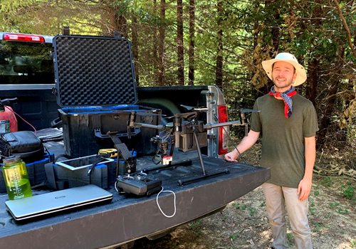
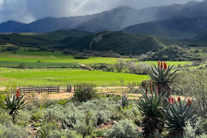
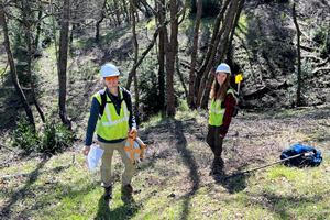
The BioSoundSCape biodiversity monitoring research project is based in the Cape region of South Africa. The project involves citizen scientists and CapeNature rangers in South Africa, coordinated by Birdlife South Africa, to deploy low-cost acoustic recorders to monitor animal diversity. Sound data are used to detect individual bird and amphbian species with artificial intelligence, as we as used to derive holistic measures of sound diversity. As part of a larger campaign in South Africa, called BioSCape, NASA will fly advanced lidar and hyperspectral (imaging spectrometer) sensors that detect structural and chemical variation in vegetation. Dr. Clark and colleagues at Point Blue Conservation Science and NASA's Jet Propulsion Laboratory will use these data to explore the relationships between chemical, structural, acoustic, and animal diversity in the Cape region. Students in CIGA help with remote sensing and GIS analysis, sound data processing, field data organization, and making maps.
This project is funded by NASA award 80NSSC22K0830
Soundscapes to Landscapes (S2L): Monitoring Animal Biodiversity from Space Using Citizen Scientists
The broad goal of the Soundscapes to Landscapes (S2L) citizen science project is to advance animal diversity monitoring from the next generation of Earth-observing satellites. The project uses sounds recorded from low-cost recorders placed in the field (i.e., soundscapes) and acoustic analysis to identify bird species by their calls and measure overall avian diversity. Bird diversity data are used by the science team to explore the benefits and trade-offs in using new and existing sensors in space for mapping of bird diversity and conservation planning. Acoustic data are also used to explore integrative measures of sound diversity, though ecoacoustic indices and machine learning to analyze broad soundscape components. The S2L project is focused in Sonoma County, an area with a diverse range of natural vegetation, urban and agricultural landscapes, including areas regrowing after multiple fires. A critical component of S2L is a partnership with “citizen scientists”, or volunteers in the community, that helped with placement of recorders on public and private lands, assisted with data management, identified bird calls in sound recordings, and worked with the S2L science team to train machine learning models.
This project is funded by NASA award 80NSSC18M0107
Predicting wildfire burn severity in California forests with spaceborne observations of 3D vegetation structure
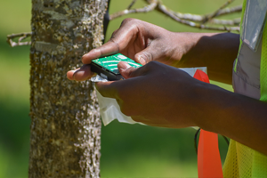
This project uses space-based sensors and other spatial data, such as winds and evapotranspiration, to model where future high severity wildfires may occur in California. A core component of this research is data from the NASA Global Ecosystem Dynamics Investigation (GEDI) sensor on the International Space Station, which uses a scanning laser to measure the height profile of vegetation at global scales. These data will help predict vegetation fuels that can influence wildfire behavior and guide forest management through targeted fuels-reduction treatments. Students in CIGA help collect ground data on wildfire burn severity from forest plots and assess fire severity and levels of fuels treatments using satellite-based products.
This project is funded by a CAL FIRE Forest Health Research Program grant (8GG21820)
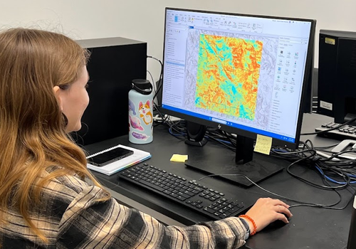
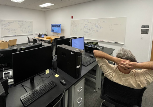
Student Research in CIGA


Recent Selected Publications

Dr. Clark and collaborator Dr. Chris Hakkenberg from Northern Arizona University presented their research, which focuses on using a NASA space laser on the International Space Station, called GEDI, to assess forest fuel loads and predict wildfire severity.

NASA recently awarded Dr. Clark an additional $99,229 to add artificial intelligence applications to his BioSoundSCape research. Read more about it here

There is a need for monitoring biodiversity at multiple spatial and temporal scales to aid conservation efforts.

Ecoacoustic monitoring has proliferated as autonomous recording units (ARU) have become more accessible. ARUs provide a non-invasive, passive method to assess ecosystem dynamics related to vocalizing animal behavior and human activity.

Citizen science is an important approach for ecological studies that require county-scale or broader geographic coverage.

Interest in ecoacoustics has resulted in an influx of acoustic data and novel methodologies to classify and relate landscape sound activity to biodiversity and ecosystem health.

We determined protected area coverage and woody vegetation change in Latin America and the Caribbean at biome and ecoregion scales, for the years 2001 to 2010.